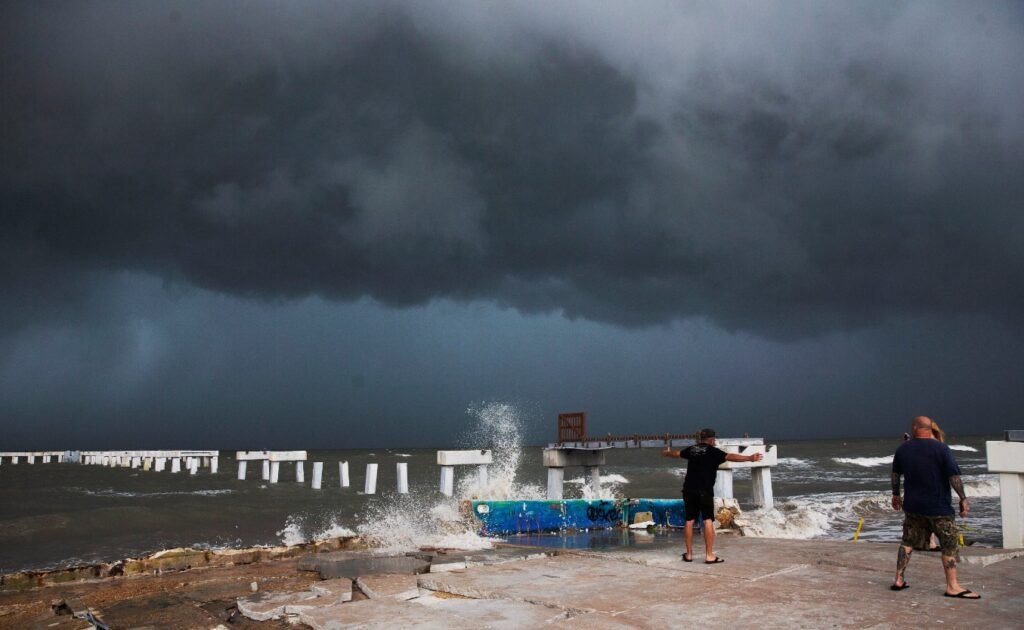
Florida is bracing for a powerful hurricane that is expected to make landfall early Wednesday morning as a Category 4 storm with winds of at least 130 mph (209 kph). Hurricane Idalia has rapidly intensified in the Gulf of Mexico and is threatening to bring catastrophic storm surge, flooding and wind damage to parts of the state’s west coast.
Evacuation orders issued for vulnerable areas
Governor Ron DeSantis has urged residents in evacuation zones to leave immediately, as time is running out to prepare for the storm. He said that Idalia is an unprecedented event, as no major hurricanes have ever passed through the bay abutting the Big Bend region, where the storm is projected to hit.

“You really got to go now. Now is the time,” he said at a news conference on Tuesday. “This is crunch time right now. We are going to be hit with a major hurricane.”
DeSantis said that tolls have been waived on highways out of the danger area, shelters have been opened and hotels are ready to take in evacuees. He also said that more than 30,000 utility workers are gathering to make repairs as quickly as possible in the hurricane’s wake.
About 5,500 National Guard troops have been activated to assist with the response and recovery efforts.
Storm surge could reach 16 feet in some areas
One of the most dangerous aspects of Hurricane Idalia is the potential for a “catastrophic” storm surge that could reach 12 to 16 feet (3.6 to 4.9 meters) in some areas, according to the National Hurricane Center (NHC). That is higher than an average city bus.
Storm surge is the abnormal rise of water caused by a storm’s winds pushing water onshore. It can cause severe flooding and damage to coastal communities, especially during high tide.
The NHC said that there is a danger of life-threatening inundation from rising water moving inland from the coastline during the next 36 hours in the indicated locations:
- Indian Pass, FL to Steinhatchee River, FL…12-16 ft
- Steinhatchee River to Yankeetown, FL…9-13 ft
- Yankeetown, FL to Aripeka, FL…6-9 ft
- Aripeka, FL to Bonita Beach, FL including Tampa Bay…4-6 ft
- Bonita Beach, FL to Flamingo, FL…2-4 ft
- Flamingo, FL to Ocean Reef, FL including Florida Bay…1-2 ft
The NHC also warned that water levels could begin to rise well in advance of the arrival of strong winds. Residents should follow any advice given by local officials.
Wind damage and power outages expected
Hurricane Idalia is also expected to cause widespread wind damage and power outages as it moves ashore and inland. The NHC said that hurricane-force winds extend outward up to 45 miles (75 km) from the center and tropical-storm-force winds extend outward up to 175 miles (280 km).
The NHC said that there is the potential for destructive, life-threatening winds where the core of Idalia moves onshore in the Big Bend region. Some weakening is expected after landfall, but Idalia will remain a powerful hurricane as it moves across northern Florida and into southeastern Georgia.
The NHC also said that a few tornadoes are possible overnight across central and western Florida. Tornadoes associated with landfalling tropical systems are often weak and short-lived, but can still cause damage and injuries.
Rainfall could cause flash flooding
Hurricane Idalia is expected to produce heavy rainfall that could cause flash flooding and river flooding across parts of Florida and southeastern Georgia. The NHC said that Idalia is expected to produce the following rainfall totals through Friday:
- Coastal Florida Panhandle and Big Bend: 8 to 12 inches (20 to 30 cm), isolated maximum totals of 18 inches (46 cm).
- North Florida Peninsula: 4 to 8 inches (10 to 20 cm), isolated maximum totals of 12 inches (30 cm).
- Southeast Georgia: 3 to 6 inches (8 to 15 cm), isolated maximum totals of 10 inches (25 cm).
- South Carolina: 2 to 4 inches (5 to 10 cm), isolated maximum totals of 6 inches (15 cm).
The NHC said that this rainfall may result in considerable flash, urban, small stream and riverine flooding.
